How to read it
Reading the recommendation level
We run both models to predict a fire sky, then read the Recommendation Level (RL) — the probability shown on the left map. The workflow on the right walks through how RL and AOD combine into a clear go / maybe / no-go call.
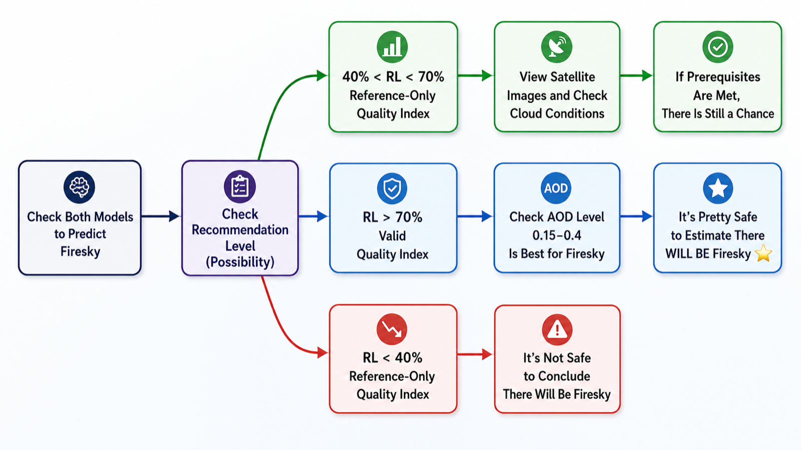
From both models → recommendation level → AOD check → a go / maybe / no-go call.
Quality & AOD
Reading the quality scale
Even when a fire sky is likely, how spectacular is it? Aerosol Optical Depth (AOD) is key — a balanced amount saturates the colors, too little leaves the sky pale, too much turns it murky. The right map scores that potential from 0 to 10. The reference below shows each level.
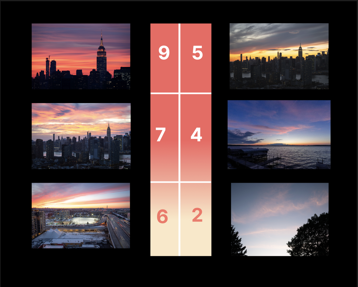
Quality reference — examples from 2 (ordinary) to 9 (spectacular).